
1 ̶ The Falls
In the mid ‘30s, between Beardmore and Geraldton, there was only one Sturgeon Bridge.
At Mile 44.4 (measured from Longlac), the Canadian National Railways tracks crossed the Namewaminikan River. That bridge is still there, though the tracks are long gone.
On Thursday, August 5th, 2021, I set out to rediscover the bridge and Kinghorn Falls, but that day trip has now stretched into weeks.
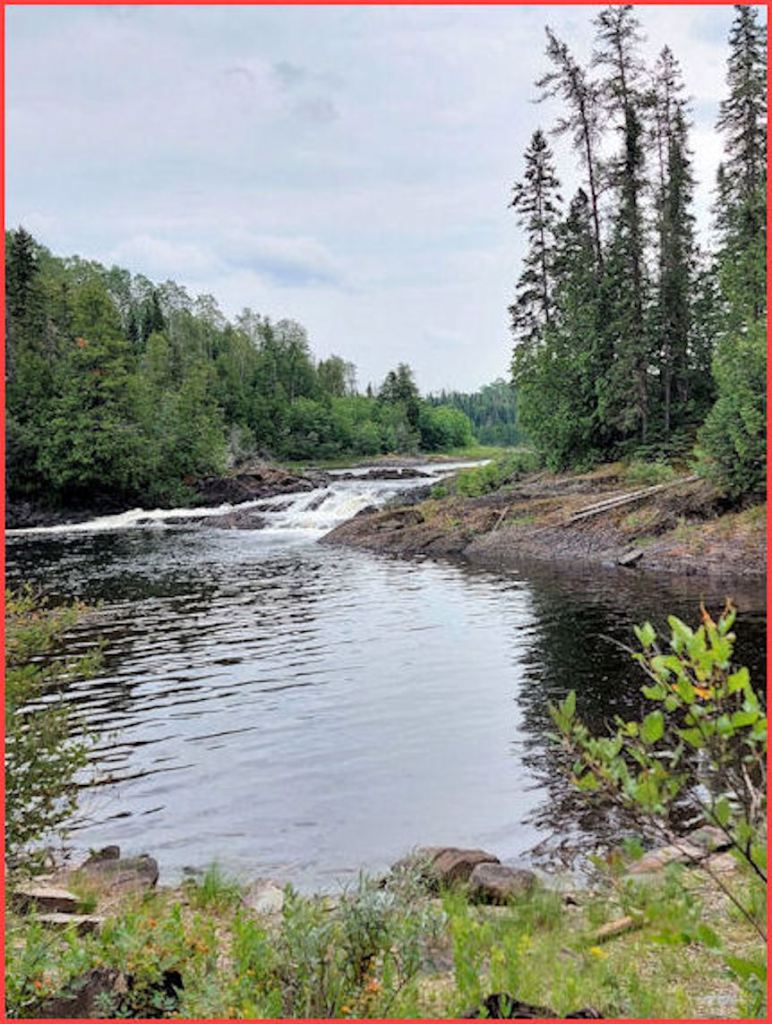
The Sturgeon Bridge crosses the Namewaminikan (aka the Sturgeon) 5.3 miles (8.5 kilometres) east of the former Jellicoe station. At that point the river leaves Partridge Lake and flows north and over the falls. I had visited the spot some 50 years ago and had a fuzzy recollection of its location.
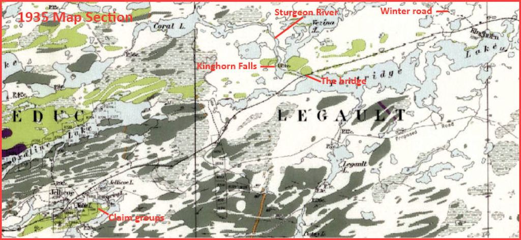
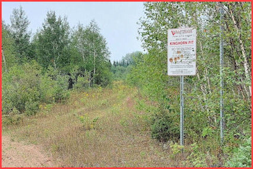
Today one leaves Jellicoe on TransCanada Highway No. 11 and drives east to the Kinghorn Road. The road is an all-weather bush road that goes north to the CN right-of-way and continues a bit farther to the Sturgeon. At 1.6 km from the highway, one passes a sign of the left: PARTRIDGE LAKE SEAPLANE BASE (also signed ARA LAKE CAMP). One crosses the culvert at the west end of the lake and almost immediately crosses the CNR right-of-way at the 2.8 km mark. The abandoned corridor is now a hard-packed all-terrain vehicle (ATV) trail.
At the 3.3 km point, a one-lane bush road veered east and melted into the bush. It’s the kind of road I favour — twin wheel tracks with a raised grassy centre. The road base must be gravel because vegetation has given up the struggle to take it over.
I continued on the comfortably wide Kinghorn Road to the river at the 5.2 km mark. The temperature hovered at 27 degrees Celsius; the skies were clear.

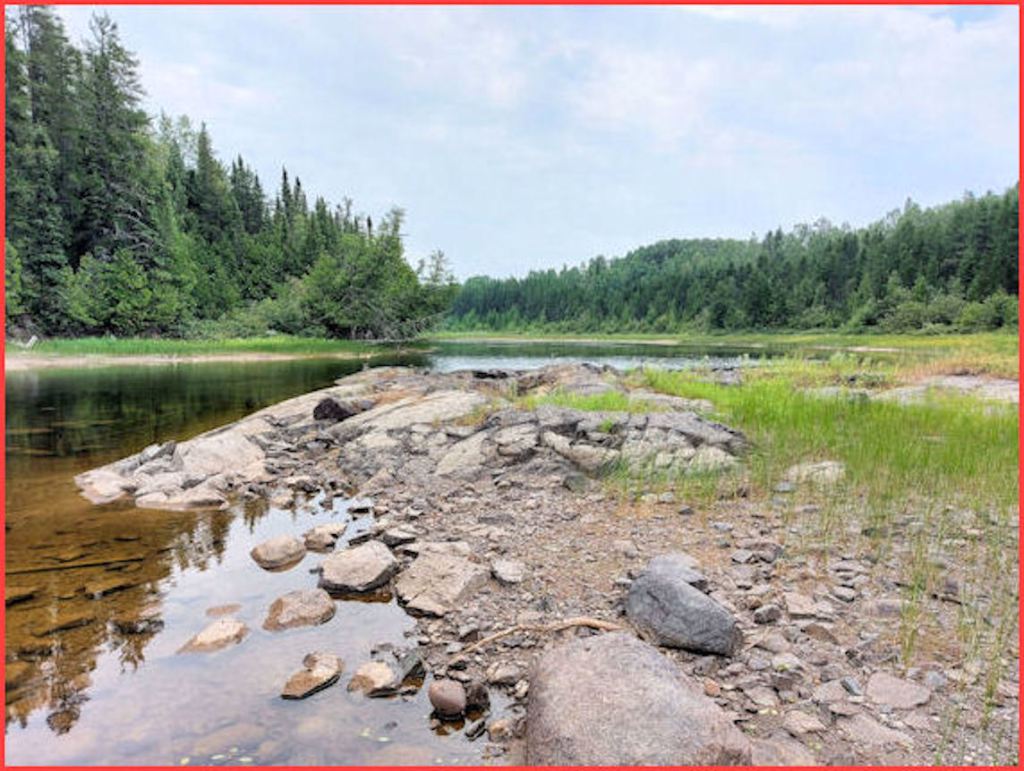
The river flows leisurely from east to west. A tell-tale sign of low water was a sand bar (or a rocky shoal) on the west side of the bridge.
Immediately before the bridge is a short bush road leading eastward to a recreational vehicle (RV) campsite. The bush police had erected a sign warning campers to limit their stays to 21 days. Five RVs and a pickup truck stood lonely vigils. I hollered “Anybody home?” and got a “Yo!”.
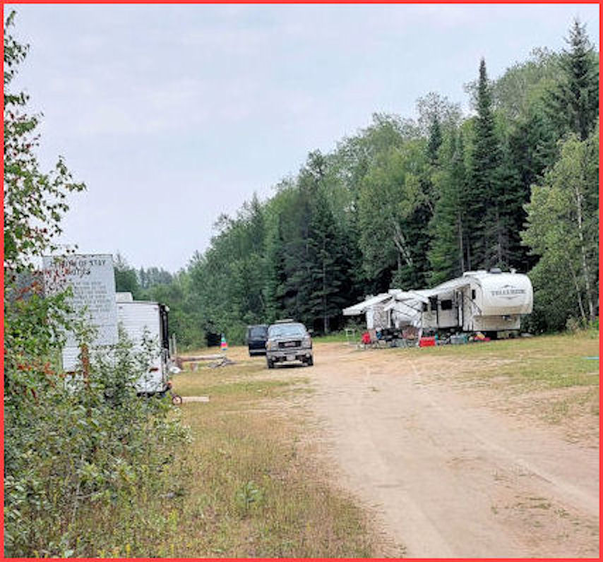
A middle-aged gentleman emerged from a camper trailer and squatted on the stoop. He was a logger, he said, from Nipigon. Been camping here for forty summers. All the RVs on the site belonged to family members. His daughter and two kids were tent-camping near Longlac at a place called Eagle Crest. It was a rotten season for camping, couldn’t have a fire, kids were finding all sorts of discarded stuff in the river because of the low water. Just had a successful fishing trip to Atigogama Lake.
Yes, he said, the bush road that heads east out of the campsite can be travelled but only by ATVs. I remembered the falls were up that road. He said the falls can be approached from the other end: drive as far as you can and then walk for ten minutes. (Well, that’s what I thought he said.)
Normally, in strange territory, I would ask Google Earth for an overview of the terrain. Today I was driving, and walking, by the seat of my pants. Didn’t even have a global positioning system device (a GPS). Like Henry David Thoreau, I wished to live (at least for a few hours) deliberately in the woods in order to meet nature on its own terms (if you discount the 2020 Subaru Forester I was driving).
I headed back south on the Kinghorn Road to the lovely road with the grassy centre. It was a pleasure to coast along. Not a single twig scratched my paint. At the 1.1 km mark I reached a small clearing and a fork. The right-hand arm led to the river, just visible. The left-hand discouraged SUVs (sports utility vehicles). I resorted to shank’s mare.
The bush on either side of the trail was dense. Twigs tugged at my clothing. Sometimes I ducked under branches. After twelves minutes, I reached the end, or rather, the beginning of the road, right back at the campsite I’d left twenty-five minutes before.
On my return, I checked every promise of an opening in the bush. I always emerged at the left river bank. One wide stretch of bank was a rocky shelf, with the river squeezed into a channel along the right bank. Was this the falls? Had the water dropped that low? (P.S. One determines the left and right banks by imagining one is travelling downstream.)
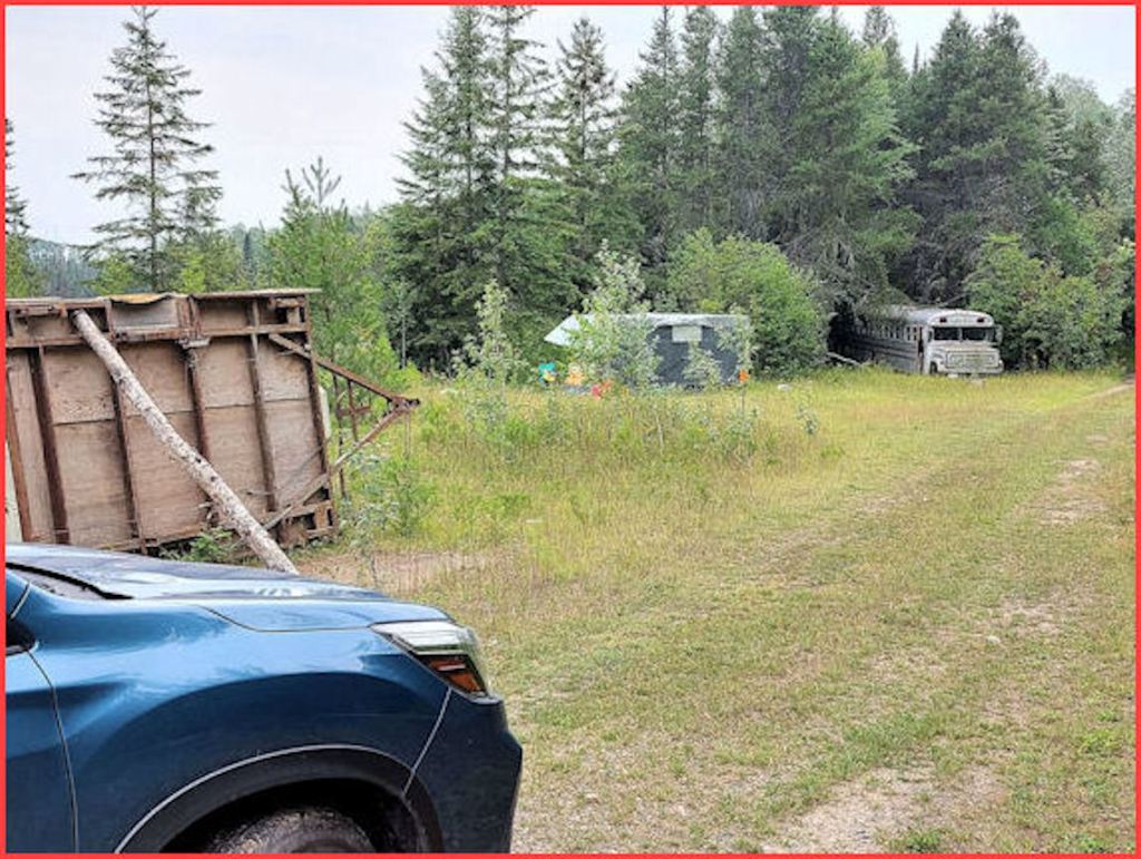
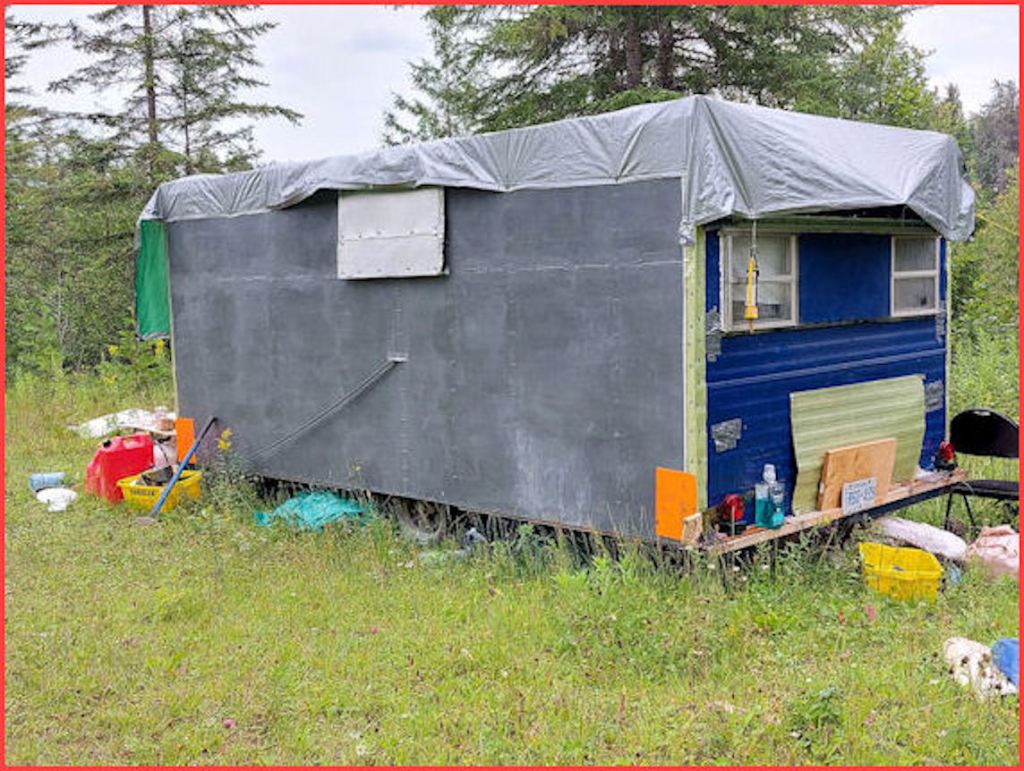
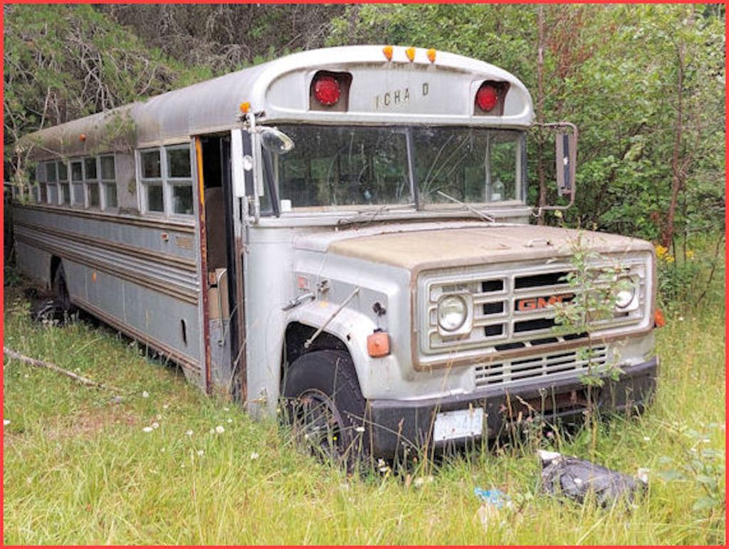
Back at my vehicle, I checked out the small clearing. It held the shell of a tent trailer, upended, sans undercarriage. A homemade camper trailer, a really crude affair. And an old bus, melting into the ground. I test-weighed the cans of gas — they were full. Peeked in the bus’s open door — detritus from party-makers.

The strangest thing was no sign posted by the bush police.
On my return to the junction with the Kinghorn Road, I discovered a trail on the left. I stopped, rolled down the window. Sound of rushing water. Just 0.3 km from the Kinghorn Road. A ten-minute walk.
“Doh”, I said to myself.

(continued in Chapter 2 ̶ The Bridge)

Enjoy the read thanks
LikeLike