IN THE BEGINNING
The Precambrian Era caused great [upheavals] of the earth in
the Northern part [of] Canada. On four occasions the [glaciers]flowed
and retreated only to return again. Eventually there were
great [upheavals] caused by volcanic action and great lava
flows[, causing] folding of the underground.
Underground[, extremely] hot water circulating formed fissures
in the rock . As the waters cooled[,] minerals were deposited
in the [fissure walls,] which eventually formed [veins] of gold .
The movements formed valleys, ridges and hills[;] this uncovered
some minerals and buried others.
The water levels were low in some places[;]this led to the
growth of lichens. Vegetation began to grow in some areas while
muskeg formed in others.
The Height of Land caused the diversion of the watershed[;]
all water on the north side flowed into Hudson and James Bays,
while water on the south side flowed to the Atlantic [Ocean].
The land mass in the vicinity of Geraldton contains formations of
granite, copper, iron, zinc, gold and [silver].
The [food-bearing] swamp areas attracted moose, [caribou]and
bear. The lakes and rivers supply a living environment for many
smaller animals such as beavers, wolves, foxes, bobcats, mink
and muskrat.
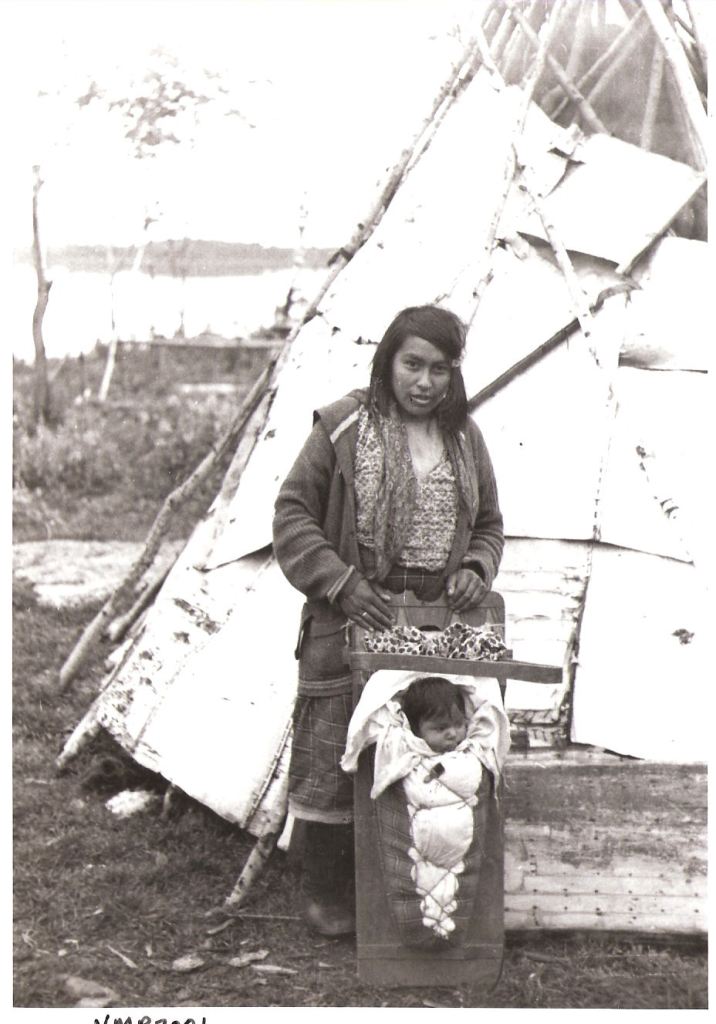
The native people of Geraldton area were mostly Cree and
Ojibwa, great hunters and fishermen. They were originally nomads
[trapping] in winter and fishing in summer. The abundance of animals
the Natives encountered soon led to their decision to harvest
and sell Mother [Nature’s] Bounty.
The Native people were very good at making their own canoes
for summer [transportation] and soon found that they could travel
to [Hudson] Bay by canoe . During the winter they used their
dog teams and sleighs.
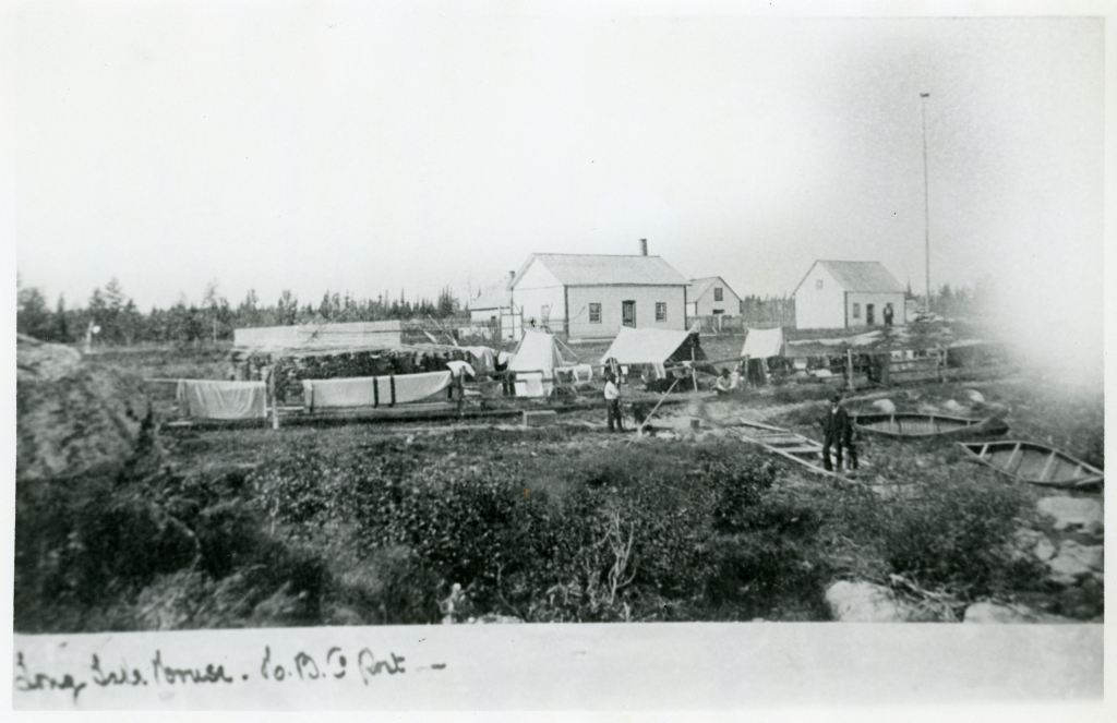
The Hudson Bay Company set up a Trading Post in this area
in 1813. [Revillon Freres] established a post at Pagwa, on the
north line of the CNR . In 1916 there was another Post started
at Cavell which later moved to Nakina. The Hudson Bay Company
set up a summer fishing camp at the narrows on Kenogamisis Lake
where Second Bridge on Highway 11 is now.
The CNR main line runs from Winnipeg through Armstrong,
Nakina, Longlac, Hornepayne and to points south . During
World War 1, the CNR built the spur line from Fort William (Thunder
Bay) to link up with the [main] line at Longlac, to ship the war
munitions and machines manufactured at Canada Car, east for
further shipment to Europe. After the war there was limited use
made of the spur line and the CNR had thoughts of [dismantling]
the line, due to the high cost of maintaining and repairing the
section while not making any use of it.
The Native people had congregated in small settlements along
the CNR line where it was [convenient] for them to set their [trap-
lines] and transport their furs to market.