
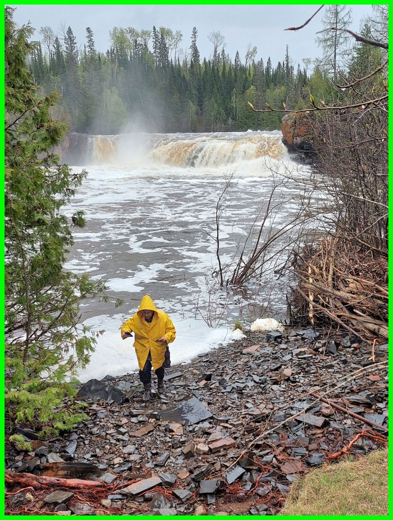
Frequent rains and the snow melt runoff promised a spectacular view of the falls on Saturday, May 28, 2022.

Under the auspices of Thunder Bay Field Naturalists, ten of us gathered at the big mall on West Arthur Street, Thunder Bay. Five vehicles travelled about 53 km south on Hwy. 61. It was drizzling, and the drizzle kept up with only occasional respites. We reveled in flat farm fields and rolling forested hills and the first greens of summer.

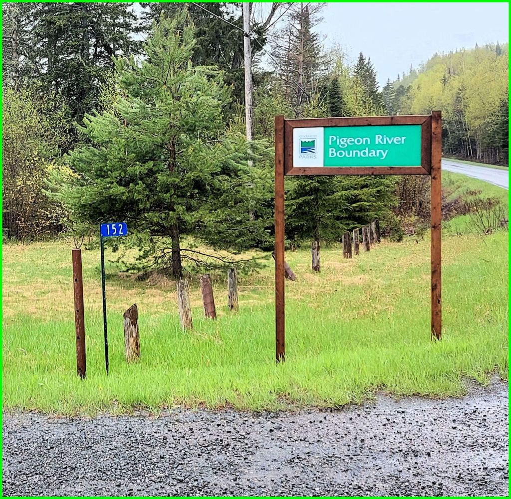
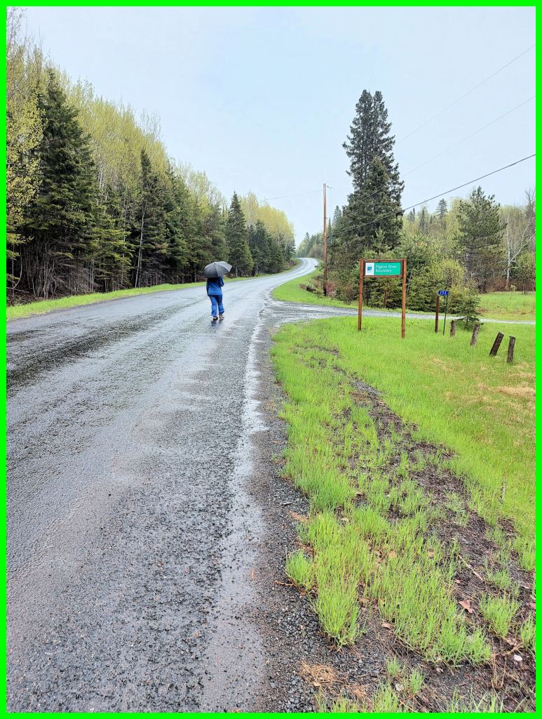
At the junction of Hwy. 593, we travelled southwest 1.5 km on a tarred road through hilly terrain. A green sign announced Pigeon River Boundary, and we turned left into a gravelled parking area in Pigeon River Provincial Park. The whole area was new to myself and sister Susanne.
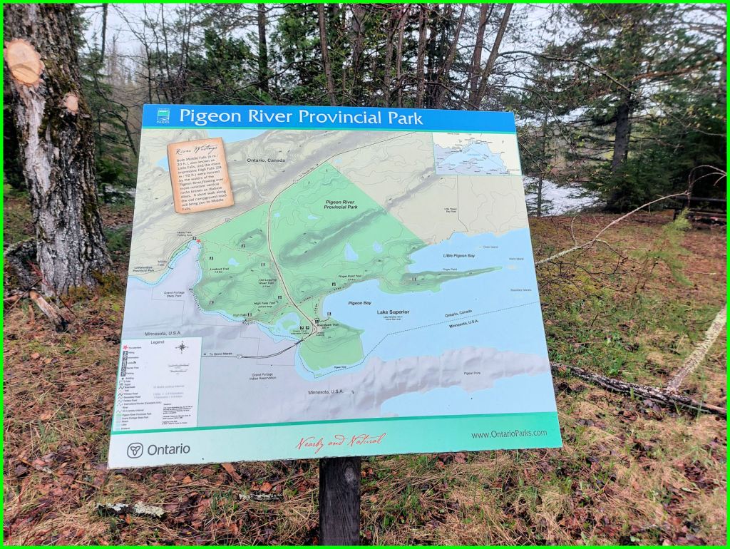
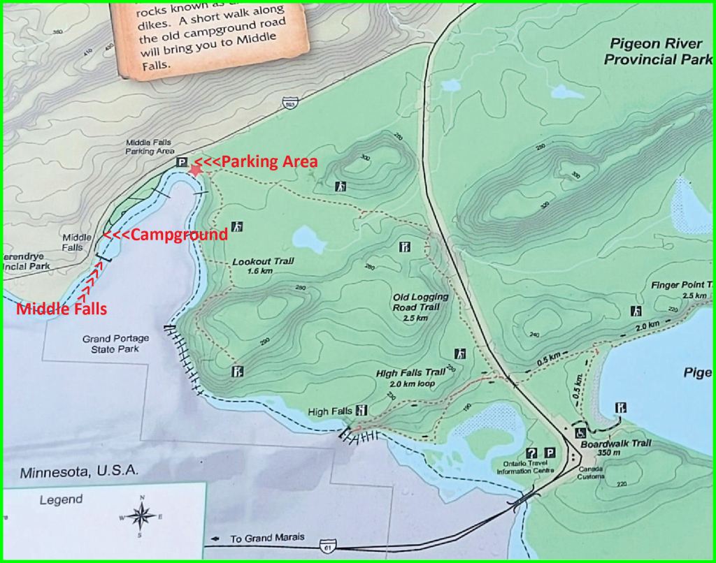
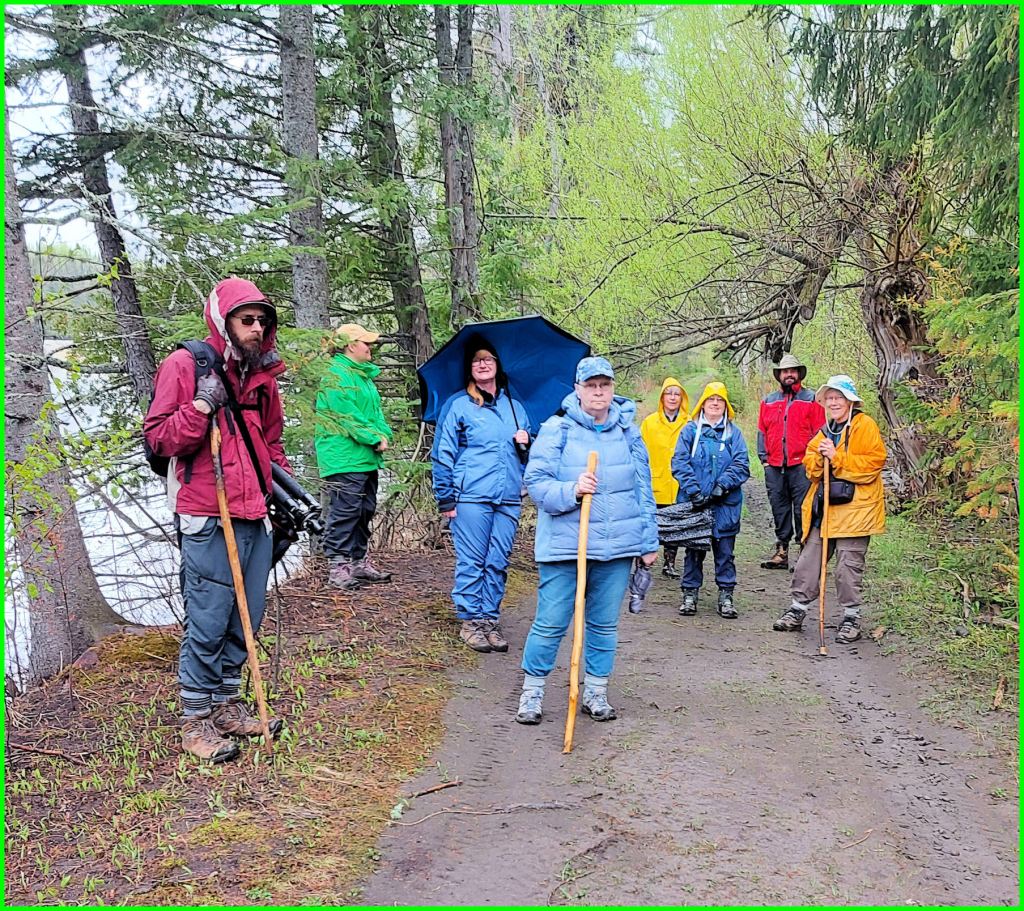
Trip leader Marian Childs cautioned everyone to pull socks over trouser cuffs to foil wood ticks. An interpretive map on a wooden post showed the trail system running southeast and southwest. About 10 o’clock, our party started hiking the trail southwestward. The river paralleled a very muddy former park road. The Pigeon had earlier burst its banks and deposited silt and debris well into the bush. We admired ancient, gnarled willow trees and stately red pine and assorted jack pine, spruce, and larches dispersed among the ubiquitous alders and varieties of shrubs. All the while, different naturalists made short treks off the trail to examine barks and leaves and ground plants about to flower.
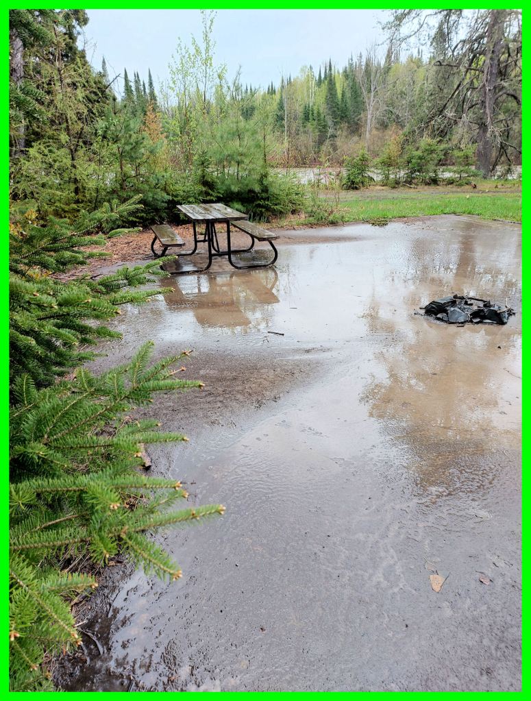
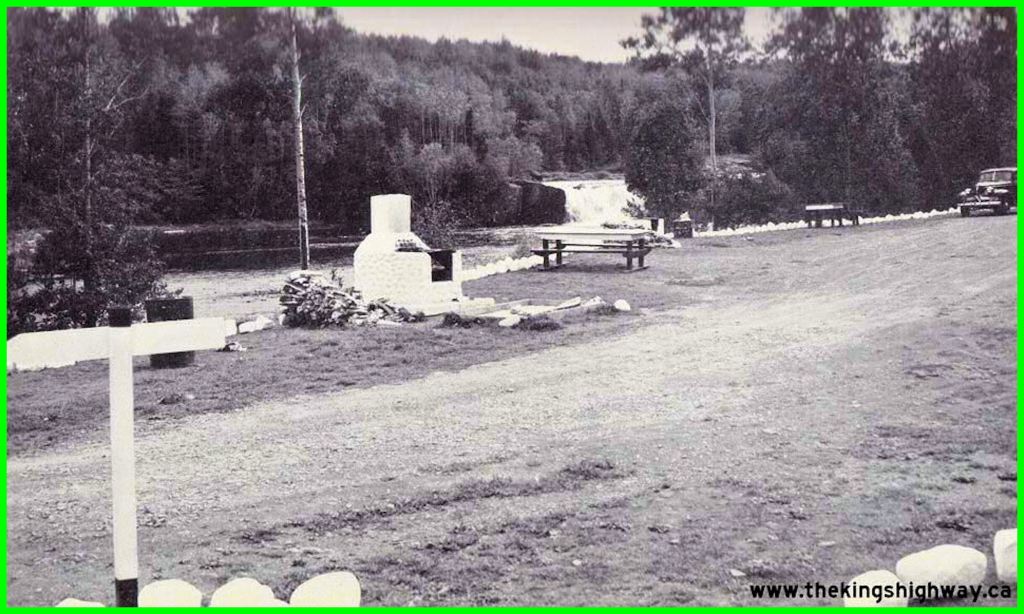
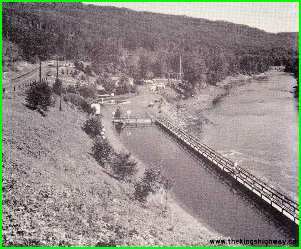
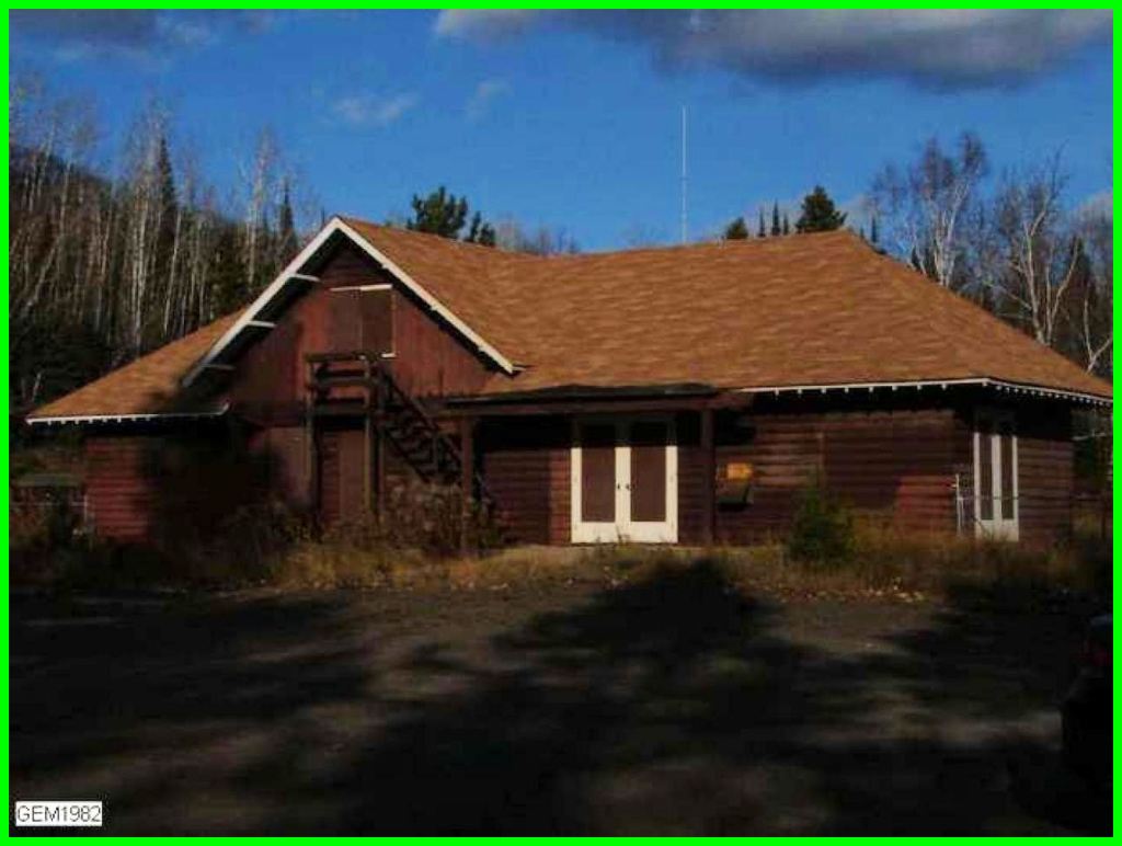
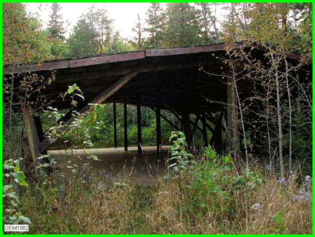
In 0.6 km we came upon the first evidence of the campground. From the beginning, Marian Childs had tantalized us with vignettes of the Middle Falls Campground. Marian had first visited the falls and store as a child. She recalled Americans crossing the river at the border just to visit the store, which sold lovely china. Today, a concrete pad, perhaps twenty by thirty feet, is the sole significant artifact of the campground. She said it had once covered a picnic shelter. The pad was covered in muddy silt.
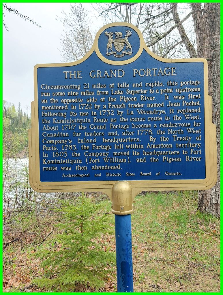
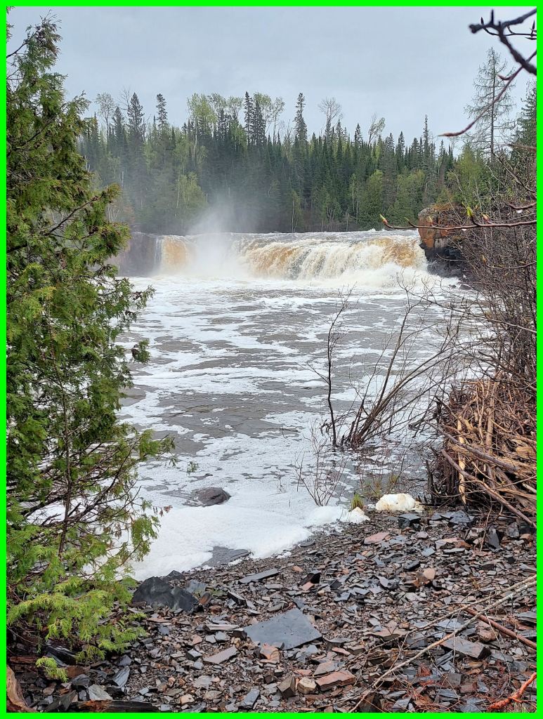
A few metres farther and we encountered an historic plaque, THE GRAND PORTAGE. The nine-mile portage (14 km) was actually on the American side of the river. It avoided 21 miles (33 km) of rapids and waterfalls on the Pigeon. A French trader mentioned its use in 1722, and in 1732, the Canadian explorer La Vérendrye chose it over the Kaministiquia route to Lake of the Woods. At this point we could see the falls and hear the roar. The trail opened up into a clearing with patches of old pavement, and immediately to the northwest we spotted Hwy. 593.
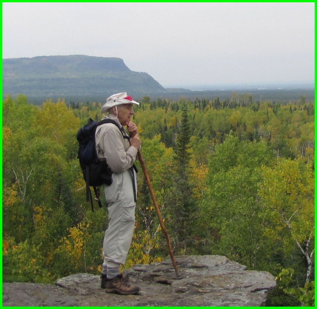
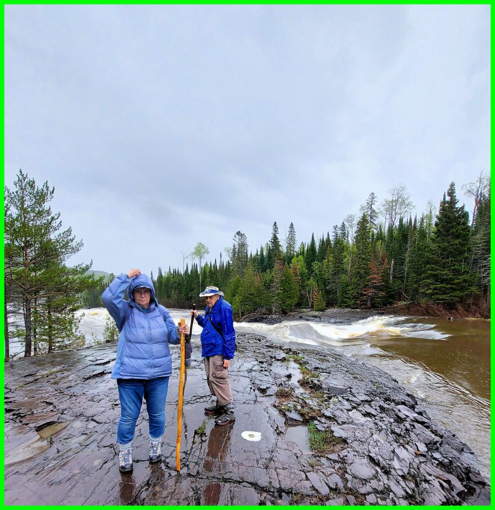
I asked Bruce Childs to pose for a picture with the falls in the background. In 2013, on a field trip to Chippewa Ridge, I snapped him leaning on his staff. At that time, I dubbed him the incarnation of Chingachgook.
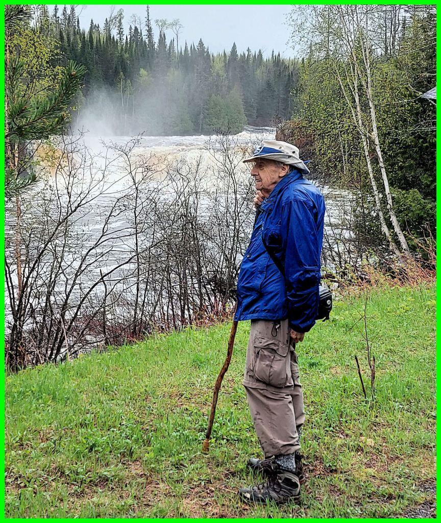
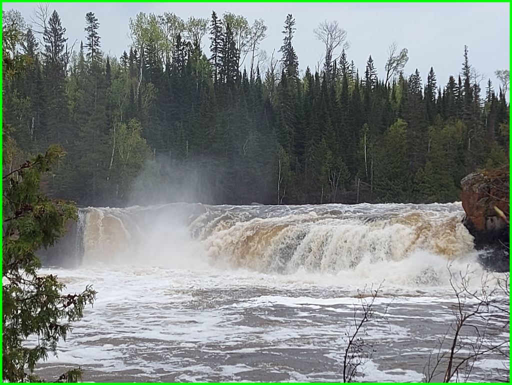
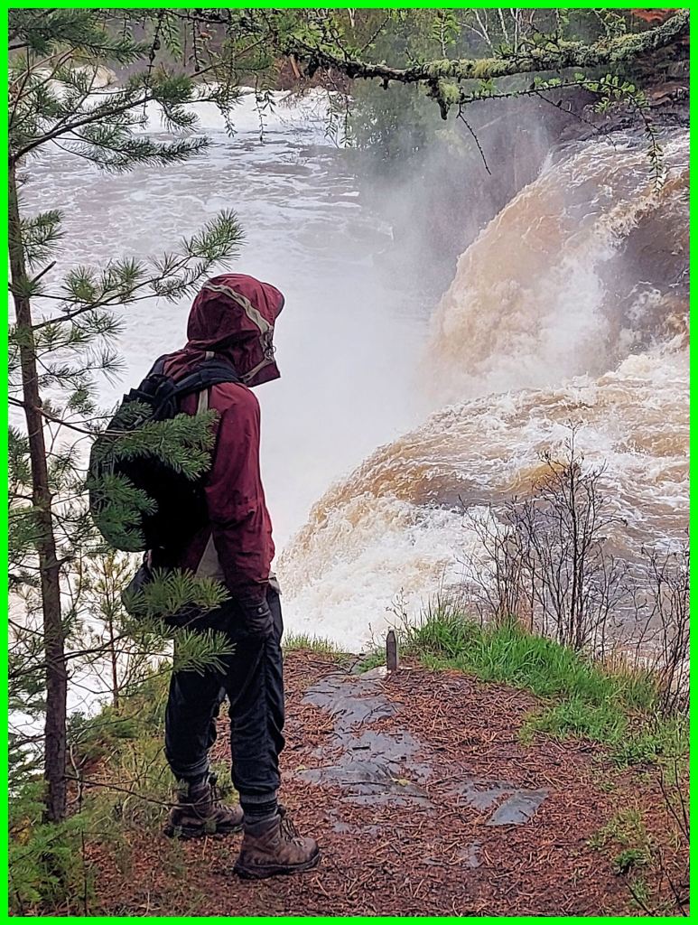
Middle Falls was meanwhile heaving tons of water over its ledge. It plunged a depth of 20 feet (6 m). A little bit farther, the ground dipped and then leveled off at a bank. From the bank, one could take super shots of the falls. A couple of the naturalists ventured down the bank to the shingly shore to get a straight-on angle.
Marian gestured vaguely to the bank area and said somewhere in there was the old swimming area and wading pool. A boardwalk and wall had separated the swimming area from the main channel. At the end of this article, please examine some of the historic pictures of the Middle Falls Campground.
The party walked up a slope to the highway upon patches of old pavement, and proceeded southwestward uphill on the shoulder facing traffic. There was very little traffic, but an unwary pedestrian could be easily surprised. On the northwest side, a tall cliff of layered rock rose perhaps a hundred feet. Marian pointed out some projecting concretions which resembled bracket fungi. Sometime in the past, people had carted two huge pieces of this “fungi” to the campground and placed them in the store’s garden, where they remain.

At the top of the hill was an unpaved pullover for traffic. A well-travelled path descended to within a few metres of the very top of the falls. One could pause indefinitely to experience the full power and majesty of Middle Falls. Bruce Childs pointed out our next destination upriver ̶ a rock point in a rapids.


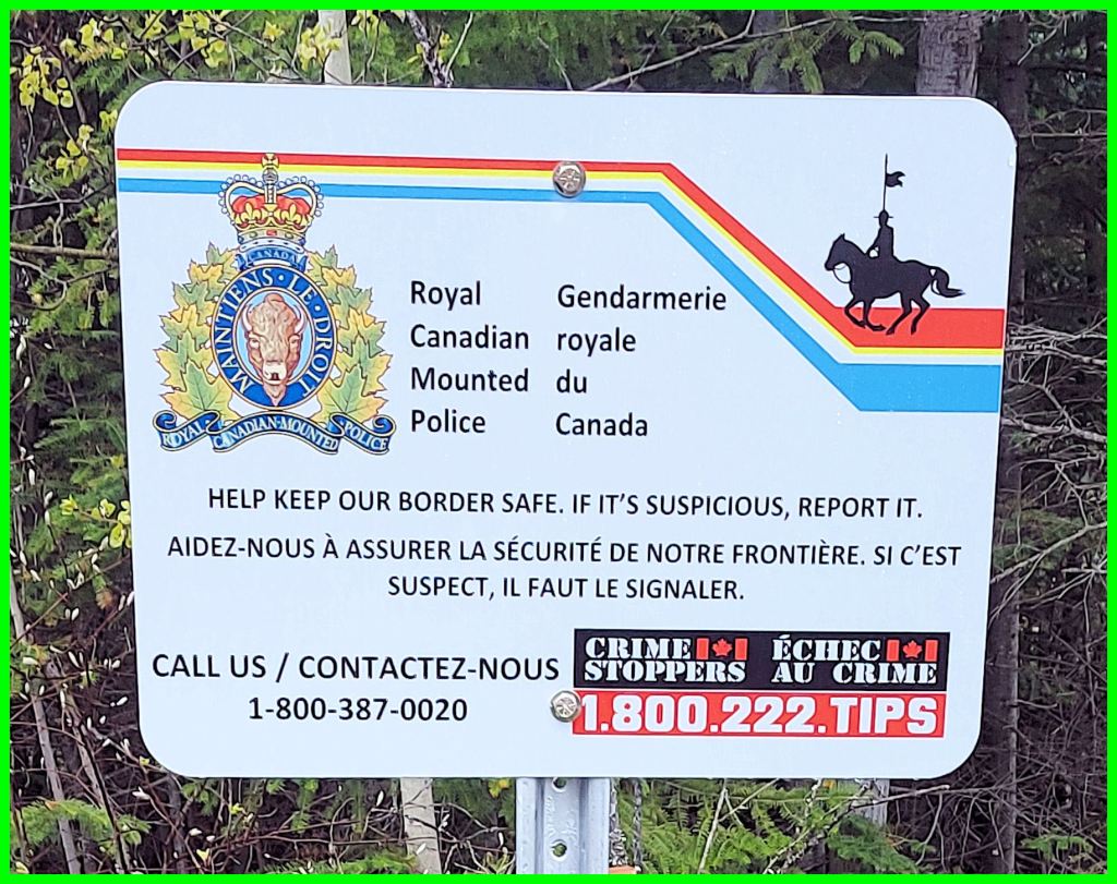
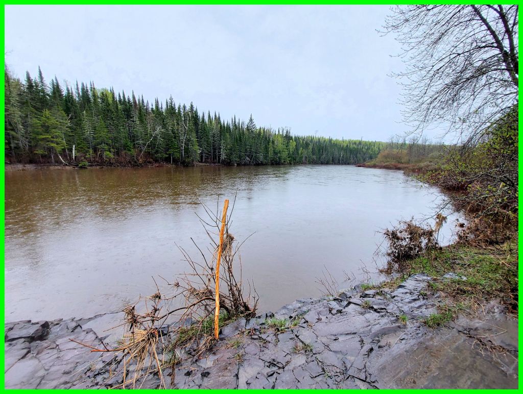
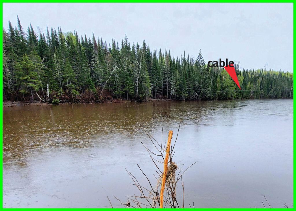
Back at the pullover, we walked a short distance to the next path. We emerged on a long rock ledge that projected into the current. The narrow channel was choked with churning rapids. Upriver, in flat water, I noticed a cable running from shore to shore. Bruce said that it supported a basket, now removed, that enabled passengers to reach either the American or the Canadian side of Pigeon River. That explained the cautionary signs posted by the Royal Canadian Mounted Police. In low water, Bruce said, one could actually walk from shore to shore.
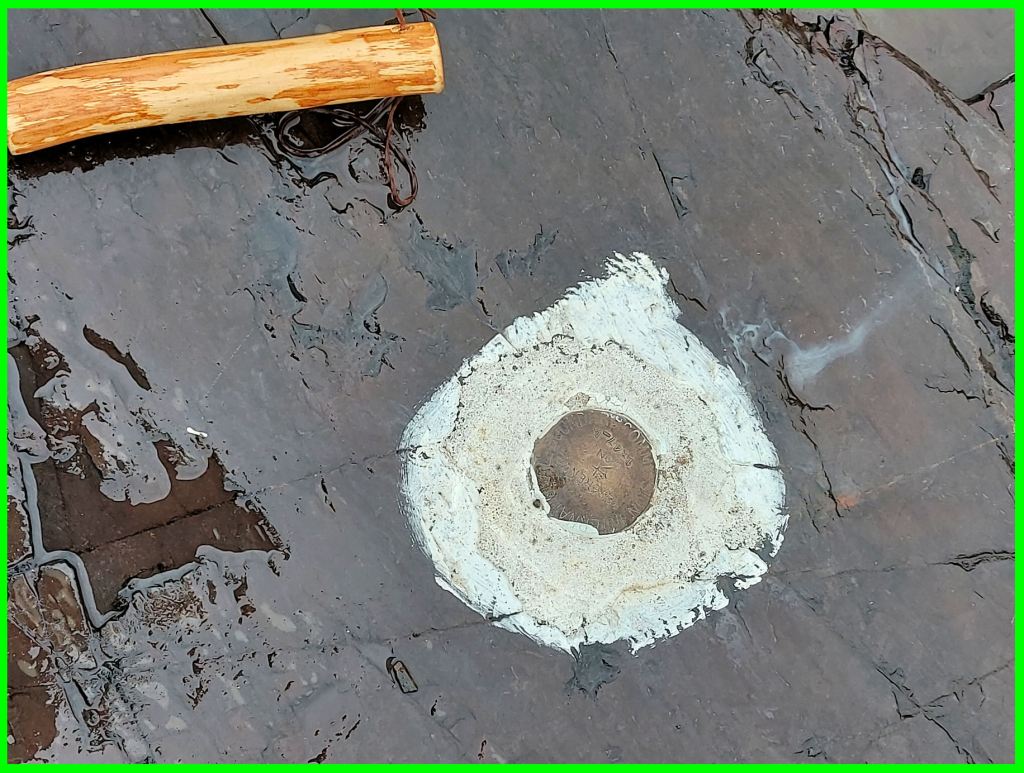
The rock ledge exhibited two old artifacts. They were brass benchmarks planted in the bedrock. The inscription on one had the words “GEODETIC SURVEY”. The other’s inscription was not readable. Someone said it was connected to the survey of the American-Canadian boundary, which runs generally east and west midway between the shores.

As we trekked up the path, we stragglers heard shouts from the river. A small group of trekkers was hailing us from the American shore. We returned the greetings. Smugglers or coyotes? As if.
Back at the highway, Marian gave a signal, and we all crossed over as a group to the lefthand shoulder. It was a leisurely hike to where we had left our vehicles.

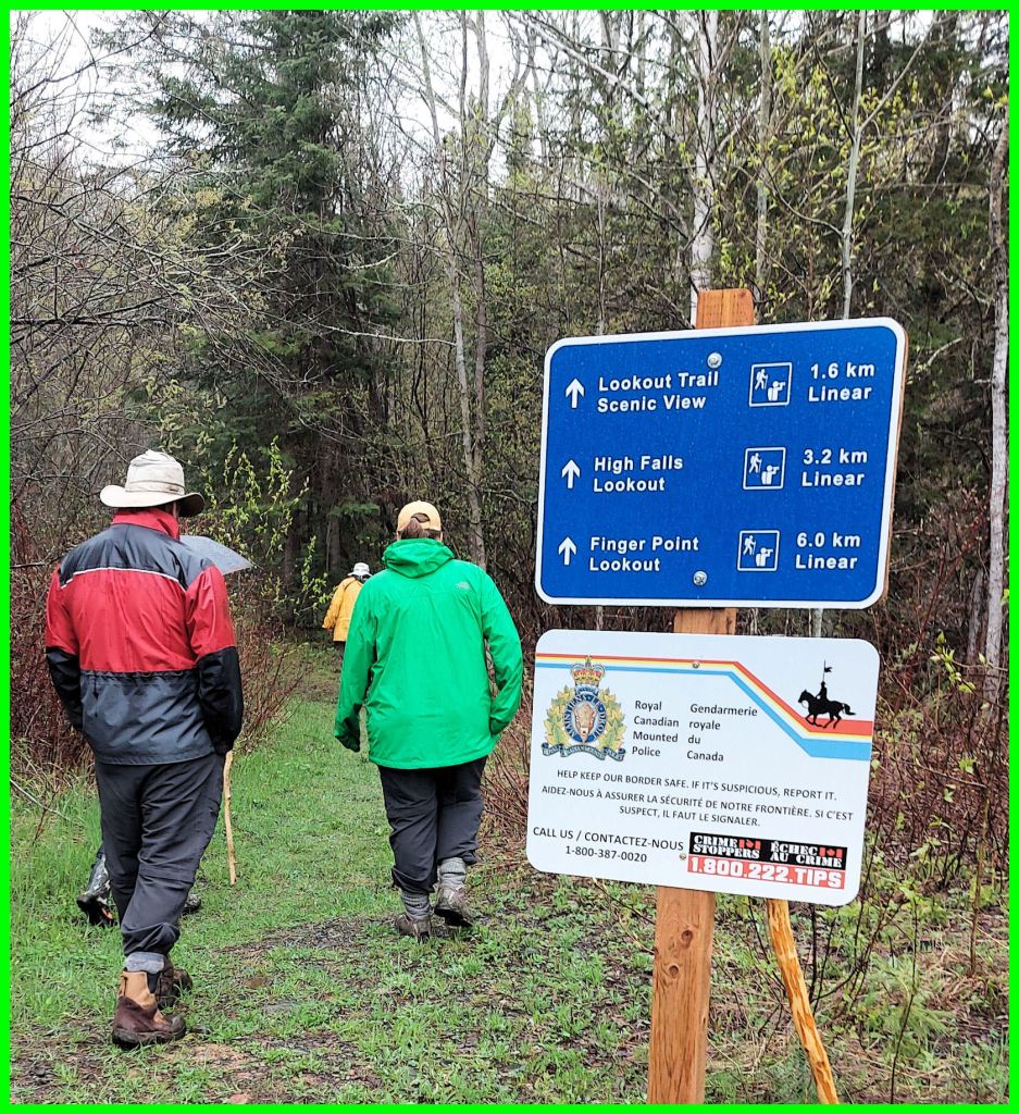
We were invited to view some marsh marigolds in flower, and we all leapt at the invitation. We proceeded southeastward on a short road to where the trail began to High Falls. We gathered that it was a rather arduous hike, involving some steep hills and some sections recently flooded by the high water.

We enjoyed the yellow beauties for a few minutes, and then tramped back to our vehicles. It was still drizzling. We removed our wet rain gear. Mike Childs found a wood tick on his camera equipment, and we all checked our socks and trousers for more of the little beasts. Everyone took a snack break before heading home. It was going on one o’clock.
High Falls is accessible from the Canada Customs area near the border. One follows the path behind the tourist bureau, which allows one to walk under the highway and follow either the high or low trails to get to the river. Both are interesting.
Long ago, when Marian’s mother was young, there was a fishing lodge located there. All that remains is the fireplace. Marian recommends that you keep to the lower, lefthand path at the fork to find her dad’s fishing spot and perhaps spot an orchid or two as well as the old fireplace.
Susanne and I will check out that path soon.
Note: Thanks to Marian Childs for the edits in this article.
HISTORIC PHOTOS
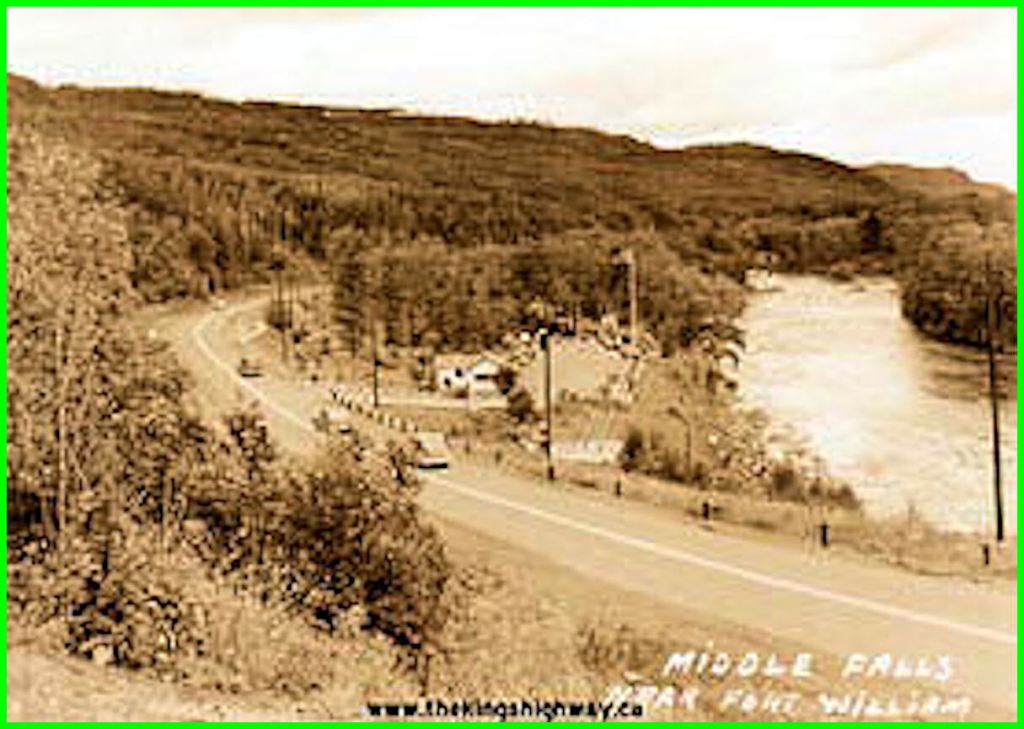
(Photo from Cameron Bevers’ historical photograph collection – Original photographer unknown)
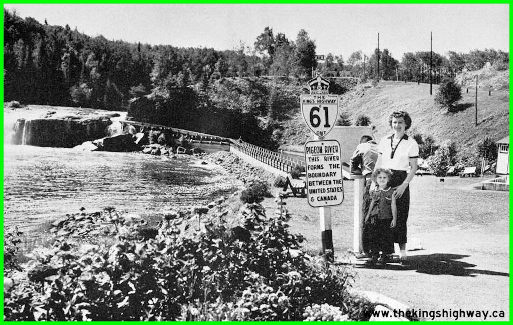
(Photo courtesy of Ontario Ministry of Transportation – © Queen’s Printer for Ontario, 1953)
THAT’S ALL, FOLKS!

Just above middle falls in a low water year and mid-summer I waded back and forth across the river. Never got my knees wet. I think I only did it was because it was illegal.
LikeLike
So said one of the touring group!
LikeLike
Awesome article. I renter going there as a kid.
LikeLike
*remember
LikeLike