
(Chapter 1 of 3)

1 ̶ The Road Begins
The name “Kenwell” established itself in the Greenstone Region by 1935, but the name has a long history. Back in the 13th century, the name originated as a family name in England, and was eventually bestowed on a now lost village in England.
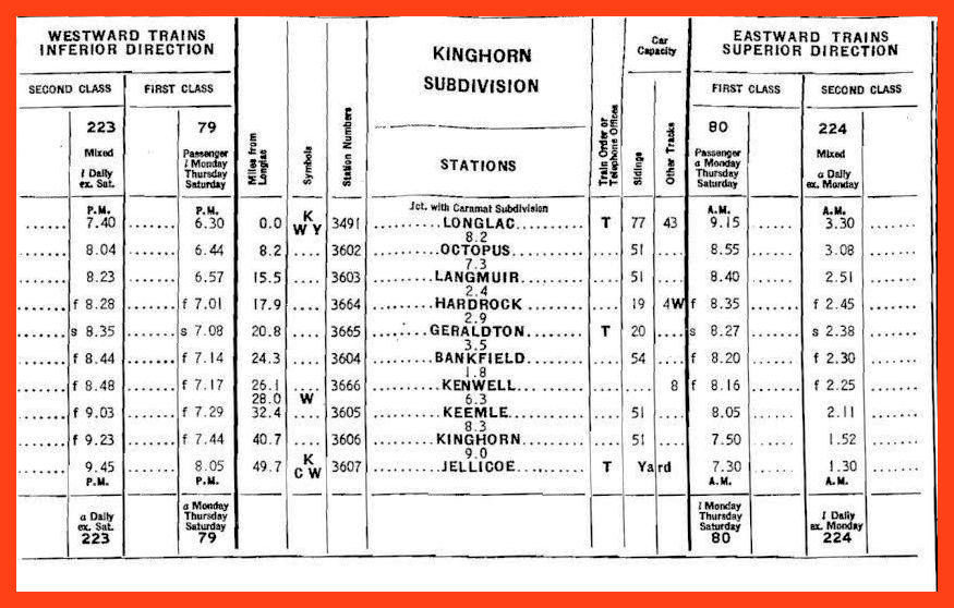
A map drawn in 1934 shows an unnamed road linking the Canadian National Railways track to properties that became the Bankfield and Tombill mines. The name “Bankfield” identified a “station”, most probably a flag stop with a section gang house, just west of the newly-minted “town” of Geraldton. Geraldton didn’t qualify as a town yet, having only a dismounted boxcar for a station together with a small cluster of buildings. In 1935, a mining report identified the unnamed road: it was the Kenwell siding road. It retains that name in local memories down to this day.
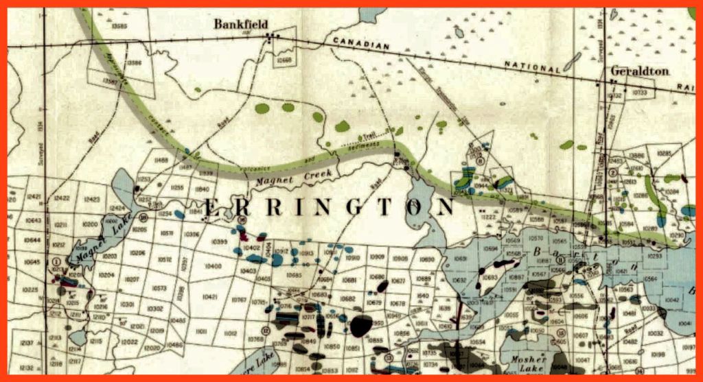
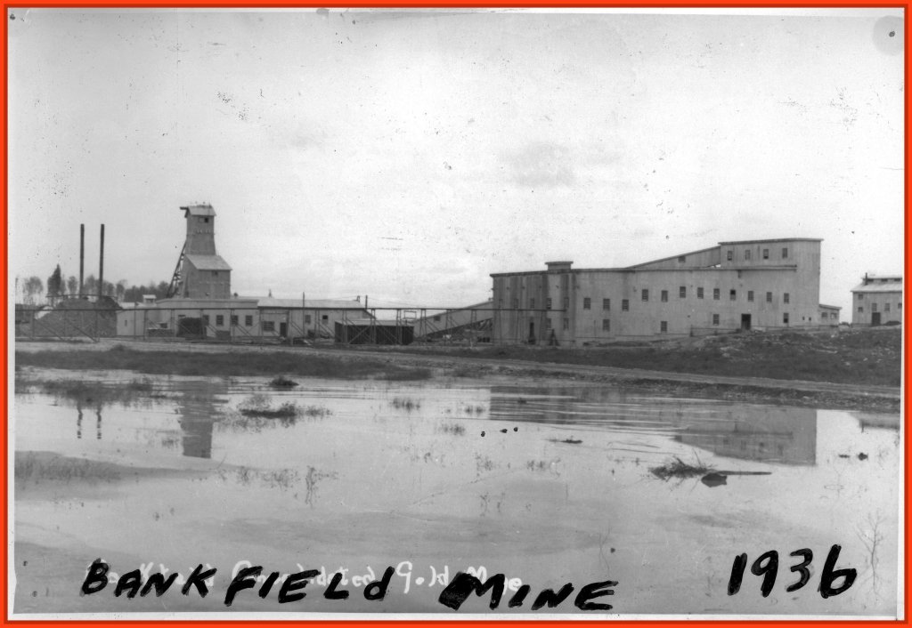
The 1934 map also shows a “road” linking the Bankfield station to the north shore of Magnet Lake. It was a seasonal winter road which traversed a broad swampland. A sketch map labeled it the Wells-Johnson road. In May, two drills, one operated by gasoline and one by steam, were transported over it with great difficulty, the bad spots in the road being corduroyed. Eventually the headframe of the Bankfield mine rose on the south shore of the lake.
In 1931, there had been a short-lived staking rush in the Little Long Lac area. Tom Johnson and Robert “Bob” Wells poked around the area. Eventually they paddled up Magnet Creek to the lake of the same name. They set up camp on the south shore of Magnet Lake. The morning of October 3rd was wet and miserable, not suitable for working, so Johnson invited Wells to cruise the shoreline of the lake. Johnson noticed a rich showing on a reef in mid-lake. Both men staked 18 claims the next day, blanketing the showing. Next spring, in early May, Johnson discovered the main vein on the south shore. After assessment work, they sold the claims
In April 1934, the property was incorporated as Bankfield Gold Mines, Ltd. The mine was accessed by a 3-mile (4.8 km) road from the unnamed railway siding that could accommodate eight freight cars. The Kenwell siding road competed with the Geraldton-Little Long Lac road (locally named Mine Road) for the title of the first road in the district.
The word “siding” needs to be clarified. The railway siding is a side track which branches off a main track. A siding is double ended (that is, has two ends so that a train may approach from the main track in either direction. A spur, on the other hand, is single ended, so that a train can park and load or unload freight without impeding another train’s passage on the main or through track. What is confusing is that some people refer to a spur as a siding. It is likely that the Kenwell siding was actually a spur
In June 1934 the company commenced to sink a shaft, having imported two boilers and complementary steam machinery, and materials for a powerhouse, blacksmith shop, dry house, assay office, a two-storey bunkhouse, stable, powerhouse, office, and a manager’s residence. John W. MacKenzie was manager.
The presence of a stable suggests that horse hauling began well before spring by using the winter road. The 1934 map that shows buildings at Bankfield station may represent infrastructure such as a stable, a warehouse, and shelters for employees. By the summer, hauling continued by using the (yet-to-be-named) Kenwell siding road.
A mining report in 1935 uses the place name Kenwell for the first time.

In 1931, after the Johnson-Wells discovery, six claims had been registered by other parties immediately west of Magnet Lake. In 1933, Johnson acquired the claims, did assessment work, and together with two partners, formed Tombill Gold Mines, Ltd., in October 1935. Two of the directors were T. “Tom” A. Johnson and W. “Bill” R. G. Johnson (Tom’s brother), after whom the mine was named.
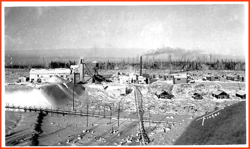
The Kenwell siding road would have been instrumental for hauling supplies from the CNR siding. By the end of 1935, the company had erected the following buildings: a bunkhouse, cookhouse, warehouse, blacksmith shop, and powder magazine. Workers sank a 21-foot shaft by hand-steel. Machinery was en route via CNR.
Notable is the absence of a stable. Very likely bulldozers replaced the horses.
Walking the ground, one can still discern the short road that linked the Bankfield and Tombill mines.
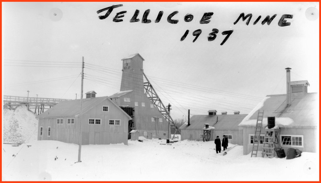
Farther west, on a rise of ground beyond an unnamed stream, another mine was being developed. Jellicoe Gold Mining Company, Ltd., was incorporated in 1934. It is not unreasonable to assume that a trail linked this mine with the Kenwell siding road.
Continued in Chapter 2.

Awesome Edger
LikeLike